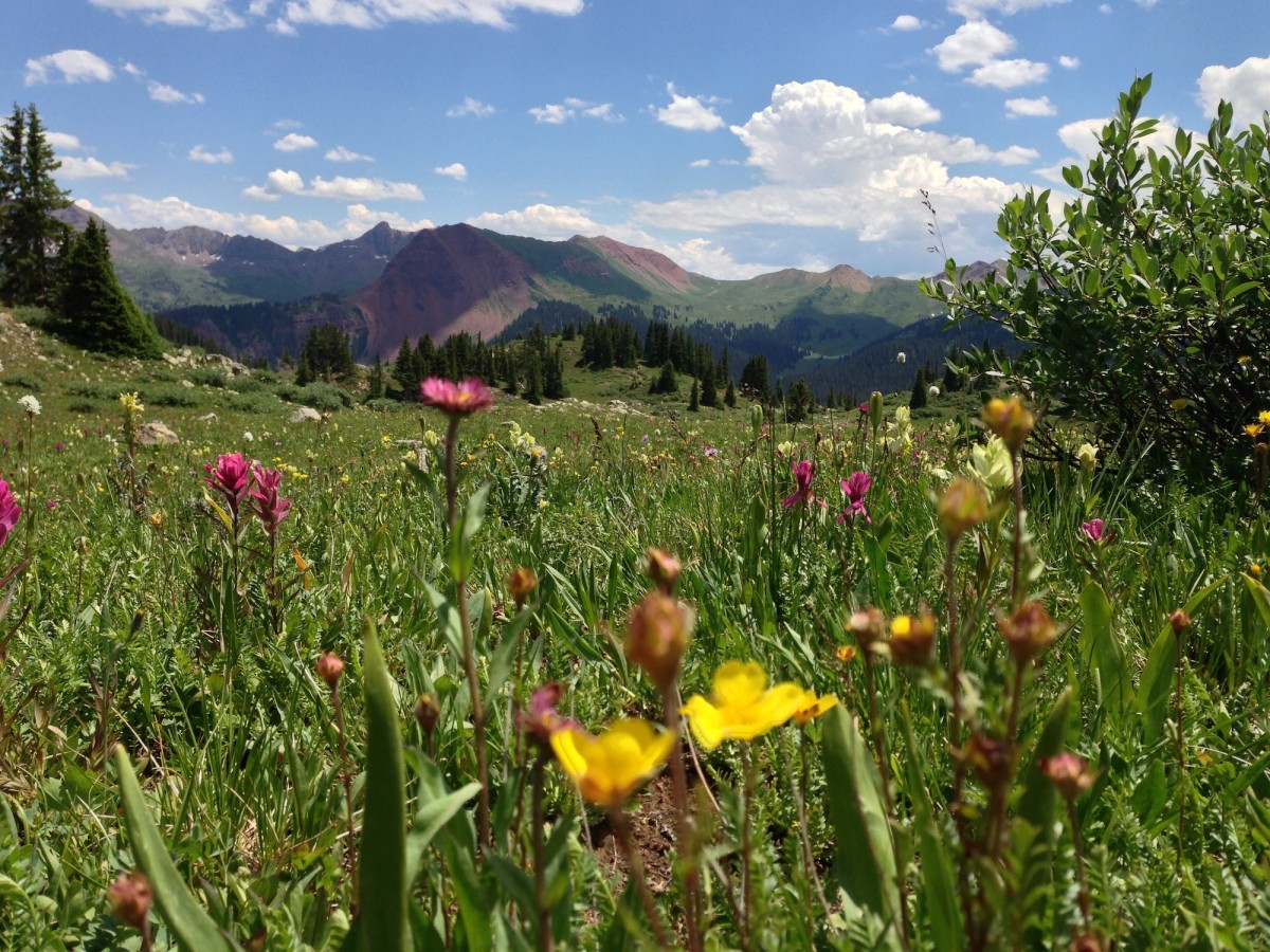
In a state that’s chock-full of mesmerizing mountain ranges and superlative vistas, it might seem ambitious to name one hike the best—yet this is unquestionably it. The 26-mile Four-Pass Loop begins at Maroon Lake and its postcard views of the Maroon Bells (the most-photographed peaks in North America, according to the U.S. Forest Service). From there, it spans vast wildflower meadows, tops four passes (each higher than 12,400 feet), and circumnavigates the iconic pyramidal peaks, all the while serving up staggeringly perfect alpine panoramas. Even bad weather didn’t mar Michael Lanza’s trek: On this route, an hour of cloudless views is worth a week of sunshine anywhere else.
BACKPACKER editors just named the Four Pass Loop one of our favorite trips ever—and Rockies readers agree, voting this their #1 hike. Here’s their advice for getting the 26-mile, four-day route’s sparkling creeks, peak-ringed lakes, and, yes, a quartet of 12,000-foot passes all to yourself. Go counterclockwise, starting at Maroon Lake (1), where the purple-streaked Maroon Bells dominate the sky. Follow the north shore on the West Maroon Trail, then turn right at the signed junction (2). Switchback .2 mile to Crater Lake (3) and a showstopping photo op of the Bells (see next page). Continue on West Maroon Trail 3.7 miles, then choose one of the established campsites edging the meadow (4). (Resist the urge to press on—the next campsite isn’t for five miles.) On day two, continue uphill, gaining 800 feet in .9 mile as you inch toward 12,480-foot West Maroon Pass(5), perched between the Mars-like rock of Belleview Mountain and Mt. Bellview. The trail then descends into Hasley Basin, where you’ll hike past meadows of Indian paintbrush and columbine (peak flowers: late July) before turning right at a junction (6). Turn right again at a three-way junction (7) and gain 400 feet to the crest of 12,415-foot Frigid Air Pass (8). From here, drop into lush Fravert Basin before reentering a conifer forest (9). Continue west for 1.3 miles to your second campsite, one of several spots scattered among ponderosas 150 feet from the North Fork of the Crystal River (10). Next morning, you’ll ford the 20-foot-wide creek (11). At mile 13.7, turn right and switchback steeply through aspen groves en route to pass #3: 12,400-foot Trail Rider Pass (12), just below Snowmass Peak. Drop to Snowmass Lake(13), your next camp. On your final day, turn right at the junction (14) and hike beneath sheer, red-rock cliffs and across Snowmass Creek before powering up to 12,462-foot Buckskin Pass (15). Look for mountain goats at mile 21.5; you can often spot nannies with kids in summer. Rejoin the West Maroon Trail (16) to finish the loop.

Trip Planner
Get there From Aspen, go west on CO 82 for .5 mile. Take second exit at traffic circle to Maroon Creek Rd. Drive 9.5 miles to trailhead. Or take the Aspen Highlands Village shuttle ($6 each way, rfta.com).
Maps USGS Maroon Bells and Snowmass Mountain ($8, store.usgs.gov)
Permit Register at trailhead; (970) 925-3445
Wildflowers
For the most flowers-per-square-inch, Goff favors the 11-mile (one-way) West Maroon Trail from Aspen to Crested Butte. From Hasley Basin, continue south along West Maroon instead of turning to complete the Four Pass Loop. In late July, you’ll pass fields of elbow-tickling blooms, including larkspur, columbine, aster, sky pilot, and lupine, as you trace the East Fork of the Crystal River. End at Schofield Park, 14 miles from town.
Shuttle: dollysmountainshuttle.vpweb.com, $15
More photos from our trip here: http://pictures.mattkocsis.com/main.php?g2_itemId=22185
Downloadable Guide: http://www.backpacker.com/2007/ripngopdfs/january2011/four_pass_loop.pdf